5 Essential Portland Neighborhood Maps
Maps have existed for thousands of years serving to help people get where they’re going and educate them about geographies and terrains. While we’re long past the practice of plotting maps on clay tablets and parchment, we all still rely on them every day.
If you’re thinking about moving to Portland, if you’re new to the area, or even if you’re considering moving to a new neighborhood in the city, a variety of good maps can help.
Many of Portland’s neighborhoods are self-contained entities full of plentiful resources within walking distance. It’s easy to stick close to home and not get too familiar with the city as a whole. But if you do plan to relocate, getting a broader view is essential.
We did some digging and found a variety of maps, specific to Portland, that will not only help you learn more about the Rose City, but will also help you appreciate the versatility of maps and the fine art of map making.
1. Clickable Portland Neighborhood Map
Perhaps the easiest way to tour the city online is provided through PortlandNeighborhood.com’s clickable neighborhood map. Each and every Portland neighborhood is written about in detail, giving local insights into landmarks, highly rated local businesses, parks, history, culture, and much more.
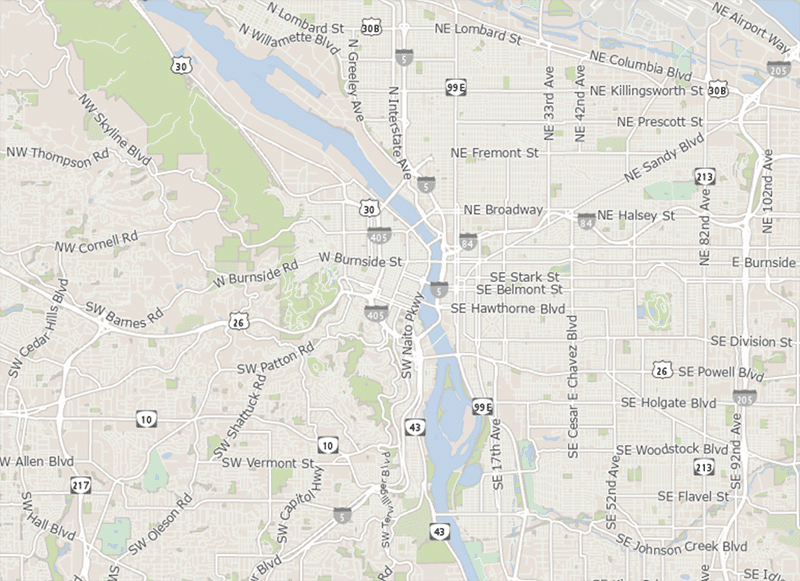
2. The 20-Min. Portland Neighborhood Map
Walkability or convenient proximity in urban environments is a hot topic these days. More and more, people who live in cities and those who plan them are aware of how walkability benefits your health, the environment, and the economy. A report from the AAARP confirms the correlation between overall health and being able to walk (or have easy access) to amenities necessary for daily living, parks, and restaurants. But as anyone who lives in a city knows, not all areas are safe or convenient. To help Portlanders know, the City of Portland planners created this 20-Minute Map.

This map uses a heat map-style gradient to compare different areas of the city and offers an immediate and comprehensive view of high walkability scores. The colors—ranging from hot yellow to blue—indicate where Portland’s homes and businesses are, along with the quality of pedestrian infrastructure like sidewalks and off-street paths. What color is your neighborhood?
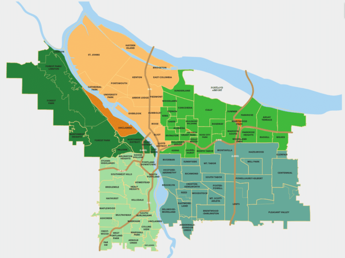
3. Portland Data Map with Neighborhood Boundaries and More
Portland’s real estate market is competitive. Having the most accurate data is important, and so is ease of use. This mapping tool does it all: zoning maps, hazard maps, historic permits, crime maps, future development maps, official neighborhood boundary maps, and more.
With this map, you can find survey information and tax assessor’s maps in Multnomah County. The map can be searched by address, tax lot number, plat name, survey number, and several other methods. Simply enter an address at Portlandmaps.com. Don’t forget to check out the “Gallery” option of all their available Portland maps at the top of the page.
4. Visual Portland Neighborhood Real Estate Map
When looking for a home, it can be tough to sort through all the information that available online these days. We have a solution: this fully searchable Portland real estate map with the powerful VestorFilter™.
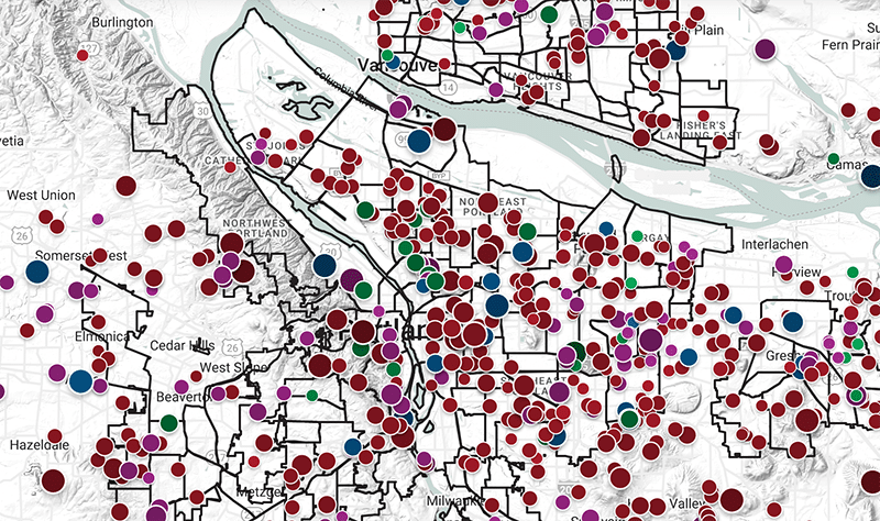
This map shows all the real estate for sale in the Portland metro area and beyond. It provides a visual real estate map search not available elsewhere online.
Dynamic icon colors: colors show property type, such as purple for condos, green for multi-family.
Dynamic icon sizes: the bigger the icon the more sq. ft. the property has.
Dynamic icon shades: the darker the icon the higher the price.
In addition to the dynamic visual icons the PortlandHomesforSale.com website has unique smart filters you can apply to your search. You can also search by neighborhood and the neighborhood boundaries are outlined on the map.
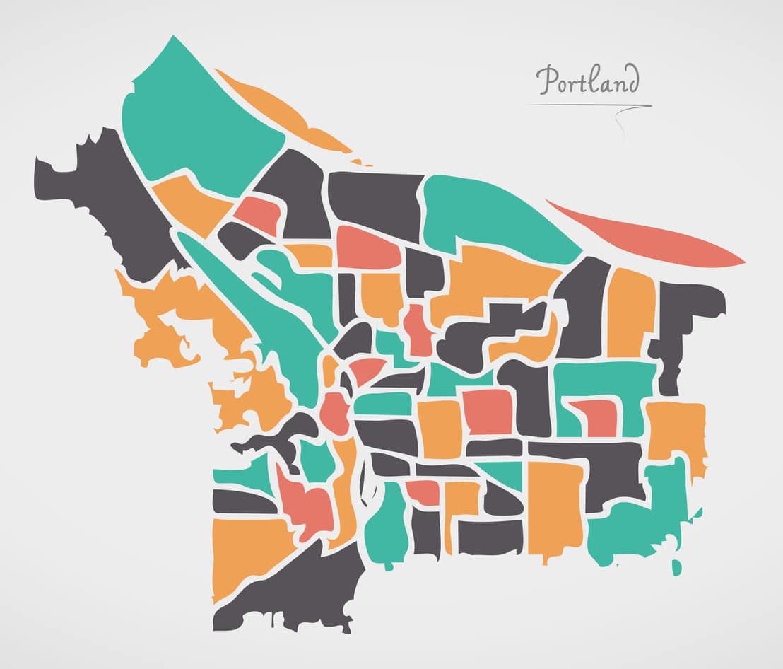
5. Portland Minimalistic Neighborhood Map
Newcomers to Portland are easily confused by the city’s layout, and it’s no wonder! All the bridges and the quadrants and the neighborhoods with names that conjure images of places far from here: Brooklyn, Woodstock, Pleasant Valley, and Boise. And what’s with all the neighborhoods with “Heights” (Arlington, Northwest, Healy, and Park Rose) and “Park” (Cathedral, University, Washington, Forest, Grant, Rose City, Woodland, Marshall, West Portland, and Mill) in their names?
And we haven’t even begun to talk about the vastly different layouts of individual neighborhoods and all the one-way streets! Portland is quirky, for sure. In fact, it’s uniqueness is one thing most Portlanders take pride in.
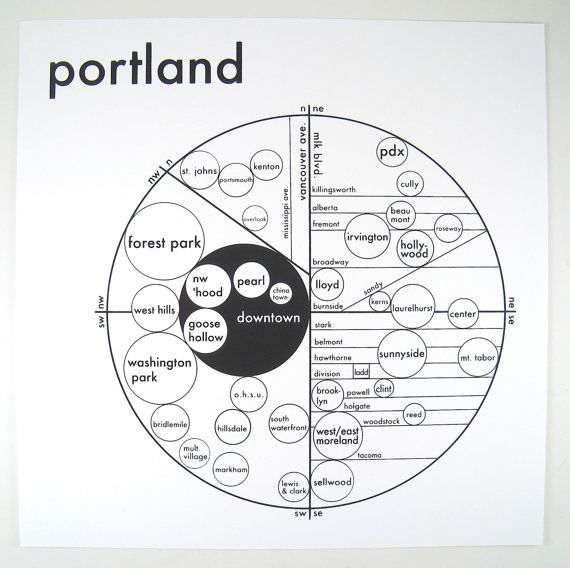
To provide a unique visual interpretation of Portland, guy named Archie Archambault made a special kind of map.
His minimalistic map is printed it on a 19th-century letterpress machine! Check it out at Slate.com, and learn about why Archie considers real estate agents as his top “insider resource” for learning the layout of cities.
Want a Seasoned Real Estate Agent to Show you Around Portland?
We’ve been helping people buy and sell homes in the Portland metro area for almost 20 years. We know the area, the trends, and the local lenders. Let us take the guess work out of the home selling, shopping, and buying process. Our top 1% seller’s team and top 1% buyer’s team are more than happy to help you learn about our city and have fun at the same time. Call us direct today at 503-714-1111 or chat with the bot on this site.