Top 5 Portland Maps for Sustainability and Livability
Portland is a city that values sustainability. In fact, Portland emerged as the most sustainable city in the country in a recent list by ParkSleepFly, which ranked cities according to renewable energy use and air pollution, among other factors. It’s no secret that Portland has been on the forefront of urban movements to promote sustainability for decades. And Portland continues to set an example of caring for the environment while encouraging its citizens’ enjoyment of it. From biking to hiking, walking around your neighborhood to traveling out of town, Portland wants people to be outside enjoying the natural world and working to care for it at the same time.
Unsurprisingly, there are several mapping tools that highlight the city’s sustainability and livability features with visual clarity. Let’s take a look at the top five Portland maps that showcase our city’s dedication to livability and sustainability.
What Makes Portland a Livable City?
The question of livability is no doubt debatable and subjective. But for our purposes here, we’re looking at a few key factors. First: mobility. How easy is it to get around using different forms of transportation? This includes automobile, bicycle, public transit, and walking. Second: outdoor space. Do the available public outdoor spaces enhance a person’s experience? Can residents enjoy being outside in a variety of ways, including parks, greenspaces, etc? And third: neighborhood identity. Are there neighborhoods with fully fleshed out cultures and strong local economies? Can neighborhood residents enjoy the area where they live, shop, eat, and play locally?
What Makes Portland a Sustainable City?
Well, this is one Portland has down over many other cities for sure. However, sustainability is a complicated issue with many factors involved. In this article, we’re really looking at how Portland makes sustainable choices available to its citizens. Whether we’re talking bike lanes, just a nice walk in the park, or shopping options within walking distance, Portland has so much to offer to keep at least this little corner of the world green.
Accordingly, we think the maps below will showcase how Portland chooses to offer folks both livability and sustainability. Check them out to see what a great place to live Portland can be!
1. PBOT’s Interactive Bike Map
With 385 miles of bike lanes, not including separate bike paths, Portland regularly ranks among the most bike friendly cities in the US. In our 2021 article on sustainability, there were only 162 miles for bikes. In two years, that number has more than doubled. And a ton of Portlanders commute on their bikes – well above the national average. While the number of bicycle commuters has dropped in recent years, the infrastructure to support bicycle commuting is firmly in place. In 2017, the Portland Bureau of Transportation officially launched the first fully interactive bike map for Portland on its website. This map makes a fantastic resource for cyclists. Whether you want to go for a ride on your day off or regularly commute to work, the map provides all the information to prepare you for your trip.
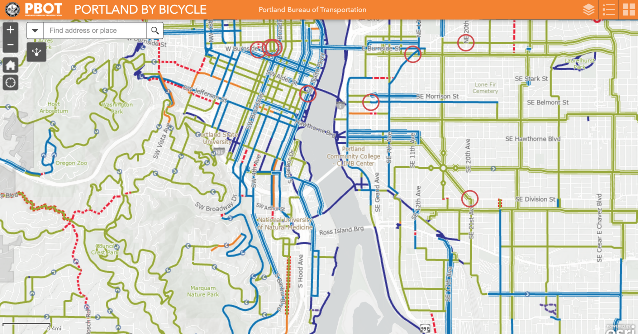
The detailed and color-coded map tells you more than just where bike lanes exist; it also highlights the locations of neighborhood greenways. Greenways are low-speed, low-traffic areas where priority is given to walking, bicycling, or rolling before vehicles. Essentially, stretches of buffered bike lanes, and various degrees of shared roadways. This has been an ongoing focus for the city that only increased during the pandemic. If you don’t think this is enough, check out the feature that will warn you of difficult connections and intersections. There’s even something they term a “layer list,” which allows you to select or deselect certain aspects of the map. For example, you might choose to add on bike shops – just in case you need a little maintenance. It also provides an aerial view option that is helpful for noting landmarks and visualizing your route. The city of Portland is working hard to ensure the infrastructure is in place to support biking over other traditional modes of transportation and through these maps help residents know how to successfully utilize the available resources.
2. PortlandMaps.com’s Alternative Fuel Station Map
If biking is not a part of your plans, driving doesn’t need to have quite such a negative environmental impact. The majority of people still drive on their work commute, but many are seeking to mitigate the environmental cost by switching to electric vehicles. But when making the switch, it can be daunting to plan your commute without knowing in advance where to recharge.
Luckily, PortlandMaps.com can help you keep the car and ditch some of the environmental guilt. Portland Maps partners with the city for some of its maps; others are privately funded. But at the end of the day, they provide some of the most detailed and extremely specific information you can find about the Portland metro area, map-wise. And this is one of those cases.
Their alternative fuel map will show you exactly where electric car charging stations exist throughout the Portland area. It also lists places to get such alternative fuels as biodiesel and ethanol. And don’t worry if you’re thinking about zipping that little electric car out for a hike. This map goes as far as Mt Hood. Or, if you’re thinking the Gorge – all the way out to The Dalles. So if you’re thinking of switching to electric, you can now plan more effectively before heading out to enjoy your city.
3. Portland Maps of Street Trees and Green Stewardship
Remember one of our pillars for livability – outdoor space? Portland has it in abundance. And it doesn’t just happen that way; it takes work and planning for a city to maintain beautiful outdoor spaces, where people can take a breath of fresh air. And while large parks like Forest Park or Mt. Tabor provide much-needed respites, they also don’t tell the whole story.
Portland Parks and Recreation provides a fantastic map of tree inventory in the city. Click on any neighborhood to find out how many “street trees” you’ll find. That’ll give you a good idea of what a neighborhood looks like (from a tree’s perspective at least). The dark green areas are local parks, and clicking on them will tell you how many trees are being maintained there. The detail goes down to what type of trees are there and how many. Not only can you get an idea of a neighborhood’s tree composition before visiting, you can be aware of any trees that may cause allergy issues for you or your family.
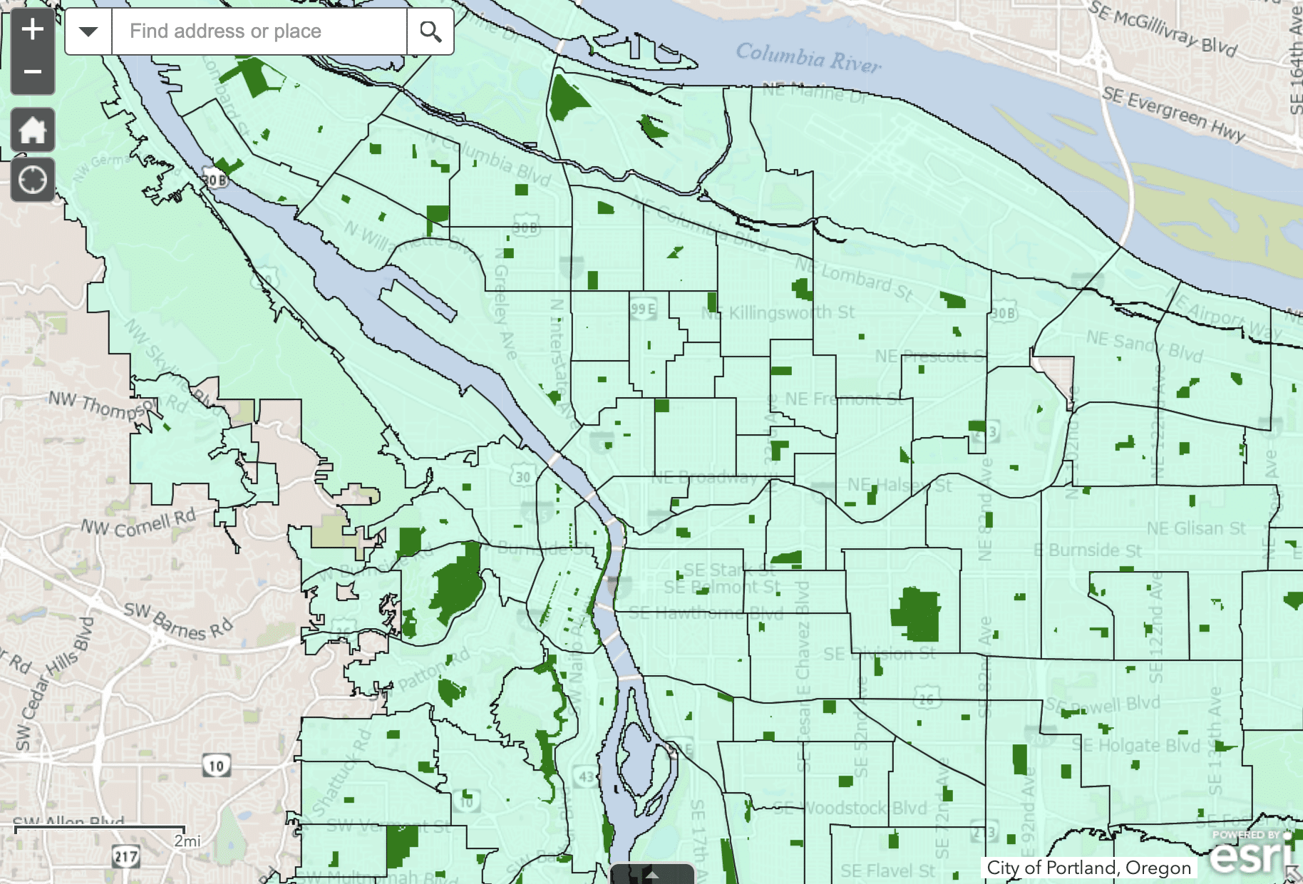
Also of note here is the Green Street Stewards Program. This program trains local volunteers in how best to maintain the health and beauty of their neighborhoods. Their map will show you everywhere stewards have signed up. This is a pretty cool way to see where folks are really invested in their neighborhood’s beauty!
4. Portland Hiking Trail Maps
No two ways about it: if you want a hike without a long drive, Portland is the place to be. From Forest Park’s 80 miles of trails in the hills of Southwest Portland, to Powell Butte over on the other side of the river, there’s plenty to be had.
Unfortunately, there isn’t one great interactive trail map the way PBOT has produced a bike map. But there are some great resources we’ve rounded up here. First, PBOT does offer what it calls “bike-walk maps,” downloadable in PDF form in multiple languages. These maps are divided by the main sections of Portland: Northeast, Southeast, Northwest, Southwest, and North Portland.
While these are pretty convention, other resources exist out there for the avid urban hiker. Portland Parks & Recreation is a great way to look up any park you find yourself interested in. They also provide a great landing page that has an assortment of trail maps. As for an interactive map, we recommend checking out SWTrails PDX. This organization prides itself on maintaining and promoting Southwest Portland’s beautiful and extensive network of urban forest trails. The map will give you information on trail locations as well as the surface material, which is great for accessibility.
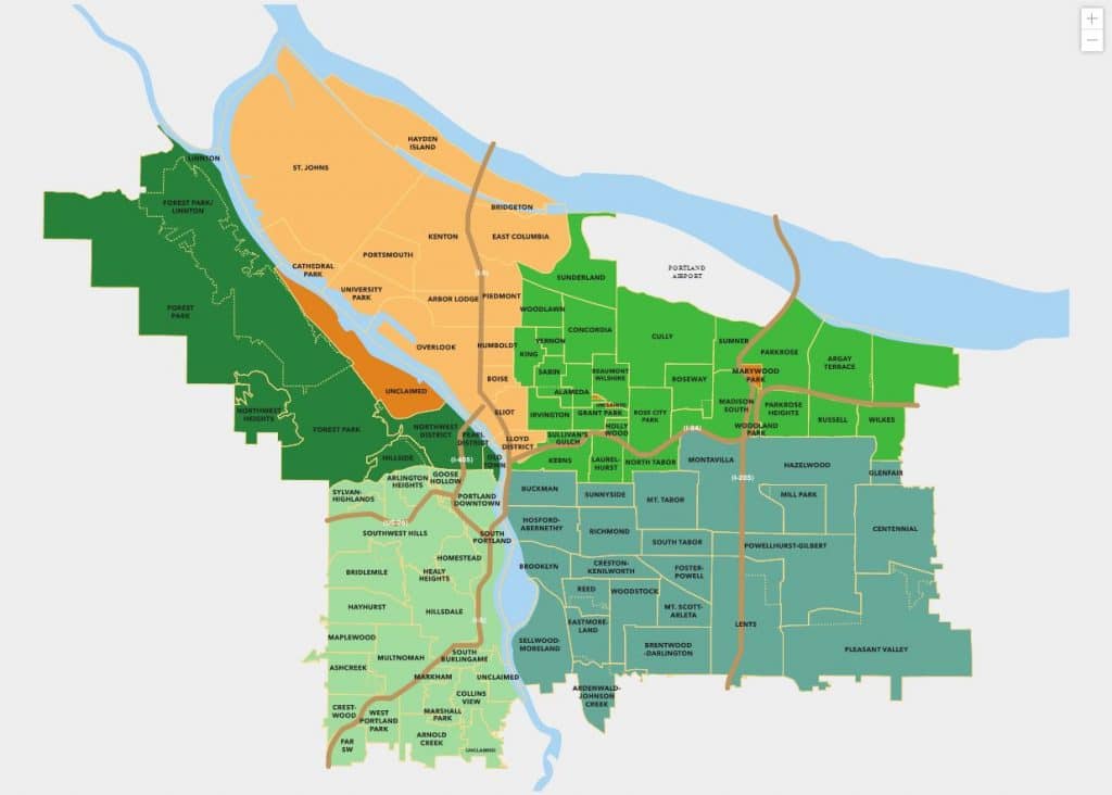
5. The Portland Neighborhood Map & Guide
Finally, if you really want to get a feel for a particular neighborhood, there’s no better place to go than the clickable PortlandNeighborhood.com map. As mentioned above, livability also means having an economy that makes a neighborhood exciting – whether that’s thriving local businesses, night life, or that ineffable something that makes a neighborhood feel like a neighborhood.
Portland Neighborhood Guide makes that ineffable something easy to understand, giving you guidance from restaurants to real estate. Its neighborhood map is one of the best ways to acquaint yourself with Portland as a whole.
Bonus: Trimet Trip Planner
We decided to add a bonus map that enhances sustainability and livability for many Portlanders on a daily basis. Trimet is Portland’s mass public transportation system, boasting extensive Max train and bus routes that encourage residents to travel anywhere in the city without the need for a vehicle. Their interactive trip planning map allows you to plan your route and estimate arrival times. As the map reveals, you are usually only a short distance from one of Trimet’s many transportation options, making this an invaluable resource for living sustainability while traveling around Portland on foot.
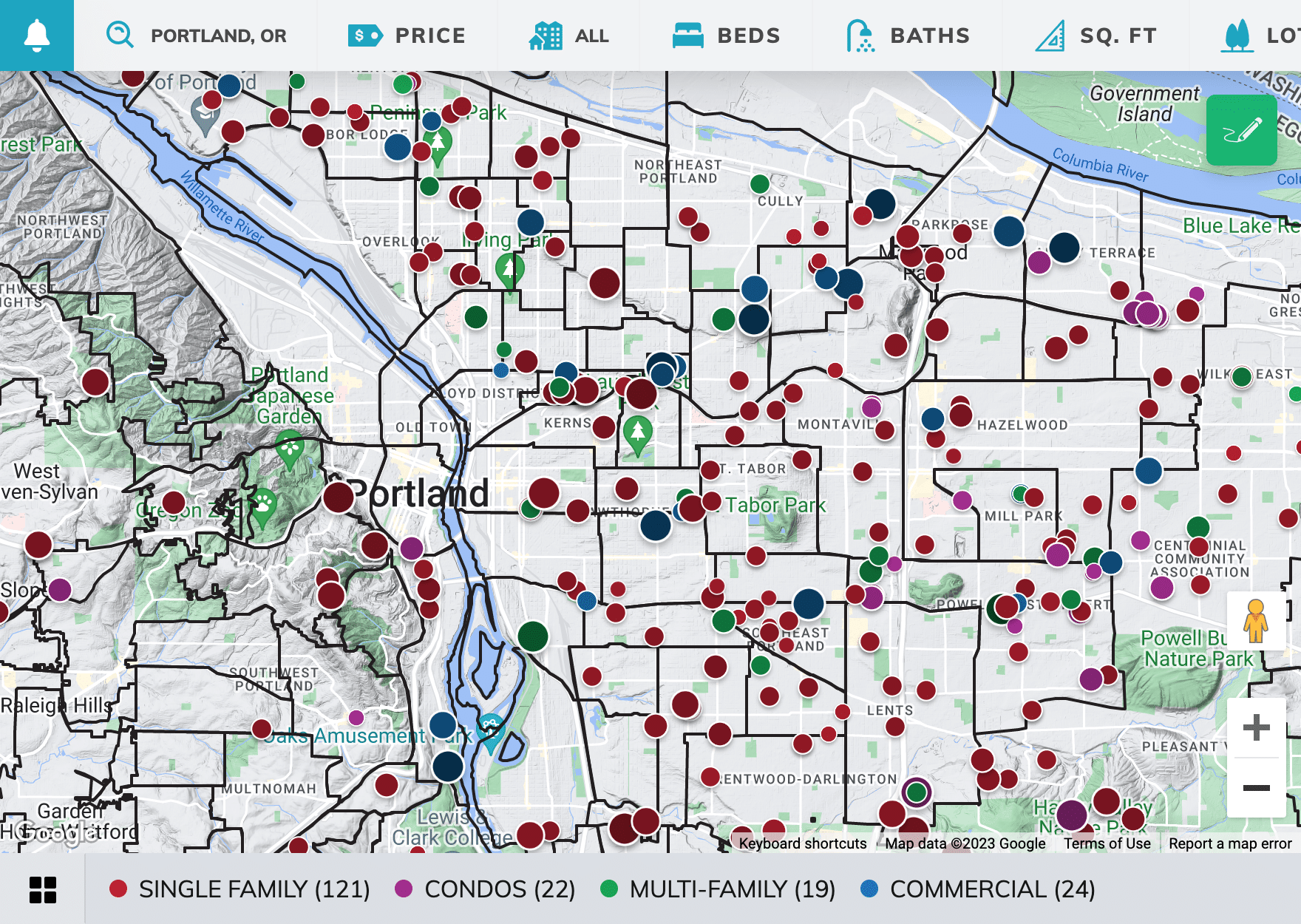
Interested in a Portland Real Estate Map?
If any of the above maps have piqued your curiosity about buying a home in Portland, there’s one more smart search tool we’d like to share. Check out Portland Homes for Sale, which will let you search for the right home in the best neighborhood for you with an interactive search engine that streamlines the home search process.
Work with a Local Expert
Whether you are looking to buy a home in Portland for the first time or planning a move to a new neighborhood, our experienced top 1% Portland buyer’s team will be happy to assist you. We have 20 years of experience working on behalf of buyers in the Portland Metro area and would love to be a part of your success story. Chat with the bot on this site or give us a call at 503-773-0000 today!